Apr 21, 2017 | Paysage>Paysages en
The first session of the Landscape Surveys entitled Four Centuries of Digital Landscapes? was held on Wednesday 21 October 2015 at the Musée de Grenoble, on the occasion of the exhibition paysages-in-situ, presented at the Musée de Grenoble and the Musée Hébert from 19 September to 2 November 2015 and extended to 18 January 2016.
In presence of: François Jullien (philosopher and sinologist), Guy Tosatto (director and chief curator at the Musée de Grenoble), Laurence Huault-Nesme (art historian, director of the Musée Hébert), Jean Guibal Daniel Marnaud (architect), Joël Candau (anthropologist), Guillaume (architect), Daniel Bougnoux (philosopher), Michael Jakob (landscape historian and theorist), Maryvonne Arnaud Monsaingeon (philosopher and curator), Alain Faure (politiste), Henry Torgue (sociologist, composer), Luc Gwiazdzinski (geographer, director of the Institute of Alpine Geography), Philippe Mouillon (artist)
Animated by Chloë Vidal (philosopher and geographer), this first survey of landscapes proposes to renew our gaze on the landscape, to ask ourselves “what made landscape” at the time of the digital life,
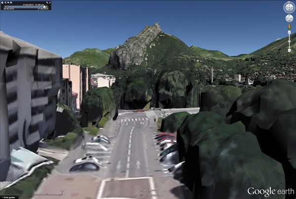
Digital landscape extracted from landscapes-in-situ (2015) latitude: 45,182 / longitude: 5,696
As a prelude to this seminar, Le Méliès in Grenoble, presented a preview of Patricio Guzman’s latest film, Le bouton de Nacre. The session, introduced by Bruno Thivillier, director of Le Méliès, is followed by a conversation between Patricio Guzman, Yves Citton (philosopher, professor of French literature of the eighteenth century at the Stendhal University of Grenoble 3) and Philippe Mouillon.
This film blends poetry and politics wonderfully, using nature in an astonishing and magical way: there are landscapes populated by immense silent glaciers that blend with majestic fjords – immutable witnesses of the past, but also tormented oceans and planets lost in The infinite of the starry heavens. These images of a wild and primitive nature, filmed like that of a forgotten planet that would be almost intact and virgin, bring us back to a world of origins where, little by little, through the black and white photographs of Indians ” Fueguinos “emerge the unknown faces of the missing people.
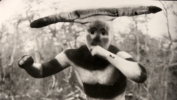
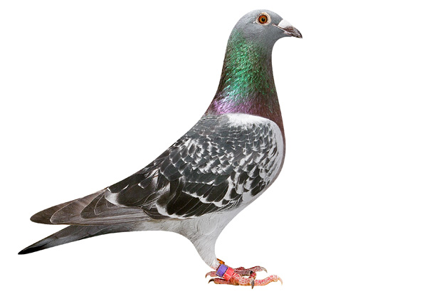
Martin Gusinde “Esprits du rituel Hain” photographie (entre 1918 et 1924)
“These natives lived for thousands of years in Patagonia, and belonged to several groups (the haush, kaweskar, and sélknam), and they spoke mysterious tongues, nomads of water, Island in the island, guided by the stars “ Patricio Guzman
Than, François Jullien develops a conference at the Grenoble Museum’s auditorium (animated by Daniel Bougnoux) entitled “Living from Landscapes“: “Landscape is a resource that is accessible to everyone because it does not involve learning. The fact that the landscape is local and makes the world, is borne by a totality, is important for the subject, the landscape opens the room on its transcendence , It is a whole of the world, it is essential to the contemporary experience. “
Martin Gusinde “Spirits of the Hain ritual” photography (between 1918 and 1924)
“In what way is a landscape exemplary of the diversity to be promoted in the world to come? But first of all in that it is a landscape, if it is precisely that one passes from the dreary extension – Uniformity – from space to the intensity of a place – for the more it creates diversity and, consequently, tension, the more a landscape is actualized: a landscape is this extensive. Makes us pass from knowledge to connivance, it tilts into intimacy and complicity, dwells at the same time that we inhabit it, who knows not how much a landscape is a resource, that we draw there indefinitely. Its tension, it reactivates us and harmonizes us at the same time? “ François Jullien
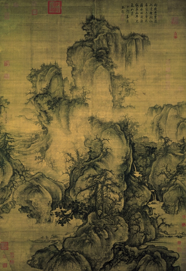
Guo Xi “Early spring” Ink and light colors on silk (1072) Taipei Museum Collection
“Looking at one thing and seeing it are two very different things, you only see something if you see the beauty … Now people see fogs, not because they are, but because Poets and painters have taught them the mysterious beauty of these effects.Flowers may have existed for centuries in London, and I dare say that there were, but no one has seen them and so we do not know They did not exist until the day when art invented them. ” Oscar Wilde The Decline of Lying (1928 page 56)
Apr 21, 2017 | Paysage>Paysages en
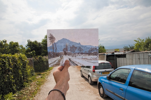
Where was the artist when he painted or photographed this landscape? This is the enigma that invites you to solve a game posted on the site www.paysages-in-situ.net, or available free by downloading the landscape-in-situ application compatible with all types of smartphones. This game proposes to choose one of some 300 paintings and photographs of landscapes of the Isère from the collections of the Museum of Grenoble, the Hebert Museum of La Tronche, the Dauphinois museum and the library of studies of Grenoble. It consists in finding the exact position where the artist was when he painted or photographed this landscape, and invites you to realize from this point of view a replica in photography or drawing or with digital mapping software such as Street view.
The best interpretations are exhibited during the Journées du Patrimoine from September 19, 2015 to January 18, 2016, at the Musée de Grenoble and the Musée Hébert de La Tronche. Then in the fall of 2016, benches will be installed on each of these geolocalized sites thanks to your answers, the landscape-in-situ application will allow you to understand the approach of the artists and to discover the replicas of all the participants.
How to refine our perceptions?
Everything seems clear and limpid in the landscape, and yet everything is strange in this notion when one dwells on it. The landscape is no longer regarded today as it was formerly regarded, when the majority of the individuals were laborers of the land, pastors or laborers, or even more recently when our daily relationship with the outside world was not yet so frequently transited through The computer screen or mobile phone.
This word “landscape” appeared late in the main European languages and at about the same time (around 1510), as if for a very long time the women and men who inhabited and practiced the territory before us had not felt the need To name this distant region. The word was used for the first time in Europe several years after the appearance of the first landscape paintings (made around 1495), and the word “landscape” first translated a painted representation before becoming a “portion of nature Which is offered to the viewer of the observer, “according to the definition of the dictionary Le Robert. This definition is also strange because it presupposes the exteriority of the viewer, that is, the face-to-face contact between nature offered, and an observer removed from the landscape, on which he brings a point of view, Which he observes without writing. Are we so sure not to be enrolled in the ecosystem of the environment that we observe?
Landscapes-in-situ (Paysages-in-situ) tries to sharpen our individual attention to the landscape, and to refine our collective perceptions by exchanging them, comparing those of one with those of others – tireless walkers or contemplatives posted at the window, Tourists of passage, native of here or heirs of other landscapes, mushroom pickers or photographers …. It is a question, in a way, of contributing by playing to make each one of us virtuoso in landscape.
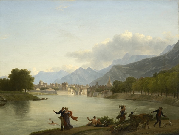
View taken in Saint-Egrève, near Grenoble, Jean Achard, 1884, oil on canvas 147 x 229 cm (collection Museum of Grenoble)
Process Overview:
Landscapes-in-situ (Paysages-in-situ) is a game within reach of everyone and offered to all – tireless walkers or contemplatives posted at the window, long-time residents or tourists of passage, native here or heirs of other landscapes, mushroom pickers or Photographers ….
Paysages-in-situ is an invitation to discover, observe and compare the works preserved in the museums of the Grenoble region, then to locate them by going to check in the real landscape the location where the artist was, there Is 150 years old, when everything has changed in this environment and which the painter had undoubtedly already sorted and composed at the time between the beautiful and the ugly, the luminous and the chiaroscuro, the fragile and the grotesque.
Surroundings 200 paintings and 100 old photographs on glass plates make up this landscape game. They are fairly rarely presented to the public (only 10% of the selected works come from permanent exhibitions). These are works from the collections of the Grenoble Museum, the Hébert Museum, the Musée Dauphinois, or the Bibliothèque de Grenoble, representing landscapes belonging to our nearby Alpine territory.
This landscape game invites everyone to compose a replica of the original view using all the tools available, from the newest ones, such as those of digital mapping, to the more classic ones such as pencil or photography. We are not so far from the copies executed by the amateurs in the museums of the end of the XIX century. But where the copying approach is lived today as a discipline, our proposal to interpret the landscape using all the tools available allows us to associate without reservation all the audiences, that of video games, Social networks, synthetic imagery, digital cartography, photography, drawing, writing …. This pragmatic choice makes it possible to cross the aesthetics by creating dynamic tensions.
Replica of Jean Achard’s painting (1884) by Christian Rau situating the site at 45,245 latitude and 5,686 longitude)
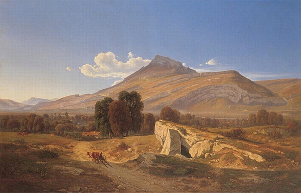
(Replica of Ernest Victor Hareux’s original oil (1892) by Andréa Bosio situating the site at 45,182 latitude and 5,774 longitude)
Paysages-in-situ offers to everyone to publicly expose its answer, during a double exhibition from September 17, 2015 to January 18, 2016, at the Musée de Grenoble and the Musée Hébert.
Then in the autumn of 2016 everyone will be able to sit on a bench implanted very precisely thanks to the quality of the localities resulting from the collaborative process and will be able to consult on his tablet or on his phone all the information available on this work and to discover the replicas Invented by the participants.
We can imagine situations where the bench will find its place easily in the site, favoring the back and forth between the past and the present, between the landscape seized in the original work and the landscape of today. But it is likely that some sites will turn out so upset that the physical inscription of a bench at this particular location will appear strange, incongruous, or will simply be impossible. This hazard will open a new dynamic space of collective reflection on the contemporary condition of our everyday environment.
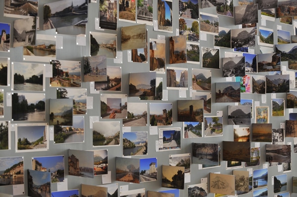
View of the wall of controversies of landscapes-in-situ, in the museum of Grenoble (October 2015)
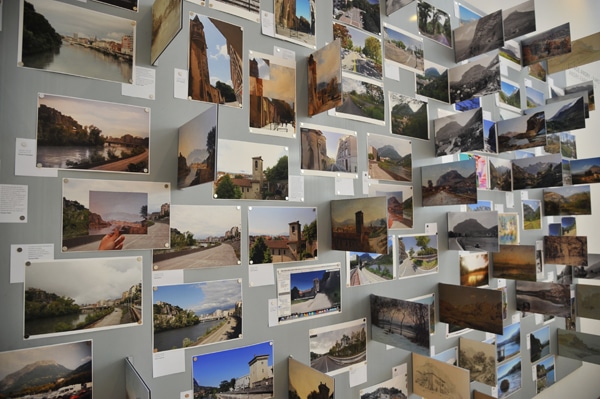
View of the wall of controversies of landscapes-in-situ, in the museum of Grenoble (October 2015)
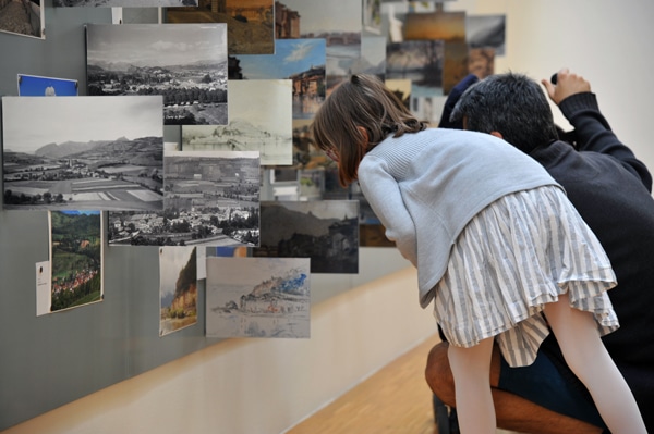
View of the wall of controversies of landscapes-in-situ, in the museum of Grenoble (October 2015)
Paysages-in-situ is a proposal of the Laboratory, produced in partnership with> the Grenoble Museum> the Dauphinois Museum> the Hebert Museum> the Grenoble Municipal Library> the Old Bishop’s Museum, the House of Nature and The Environment> Grenoble Office of Tourism> the CAUE of Isère> the Méliès> the CNRS-PACTE Research Laboratory> the National Education (DSDEN of the Isère and DAAC). In a media partnership with the Dauphiné Libéré, the Petit-Bulletin and France 3 Alpes.
Landscapes-in-situ, a device for popular innovations around landscapes, is carried out with the support of> the Rhône-Alpes region> of Grenoble-Alpes-Métropole> of the Department of Isère> of the city of Grenoble> Culture and Communication, within the framework of calls for innovative digital cultural projects> of the House of Human Sciences-Alps, under its program 2015 on the digital humanities> UMR LITT & Université Grenoble-Alpes and CNRS under the AGIR-PEPS program “Media Ecology”.
Apr 20, 2017 | Laboratoire fr
Marseille-Provence 2013, the European Capital of Culture, and the Logirem Foundation present a preview of a collection of collections, a curiosity cabinet of urban scale proposed by Maryvonne Arnaud and Philippe Mouillon and produced with the participation of numerous collectors
This Collection of Collections draws a sort of lacunar portrait of collectors, dissimilar portraits because no collector resembles another, simply because no imagination resembles any other.
This Collection of Collections is therefore an invitation to walk in the abundance of human imaginations, in the infinite diversity of the living. Collected objects can be simple or valuable. They were all scattered throughout the world and were assembled side by side, gathered here, by the obsession of the collector alone.
We must approach the Collection of Collections as we approached children in those games where, by linking points scattered on the sheet of paper, there arises an unexpected


Apr 20, 2017 | Laboratoire en
A world of worlds
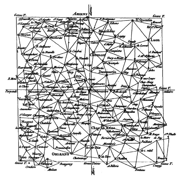
In the middle of the XVIII century, at the request of Louis XV, Cassini de Thury will establish the first topographic survey of France. For three years, between 1758 and 1761, he set up his observatory on the commune of Saint-André-la-Côte at Signal, at 934m of altitude and 20 kilometers of Lyon, to establish by triangulation the first map of Lyon.
In four generations, the Cassini will make the first topographic and geometric map of the whole kingdom of France, established at the scale 1/86 400.
These works are so reliable that many researchers – archaeologists, historians, geographers, botanists, landscapers … are now consulting the Cassini map when they need to do a retrospective analysis of the landscape.
It is from this signal that will be released, on June 25, 2017 at 11 am, pigeons passing with them messages collected from the inhabitants of the Monts du Lyonnais. Everyone, child and adult, native of here or other territories, is invited to express on a message a geographical point that is particularly close to his heart. This affective attachment to a particular place can be based on different reasons – its place of birth, the memory of a romantic encounter, a dream of paradisiacal holidays, the pain of an exodus … and concern a territory in the vicinity near or located At the other end of the planet.
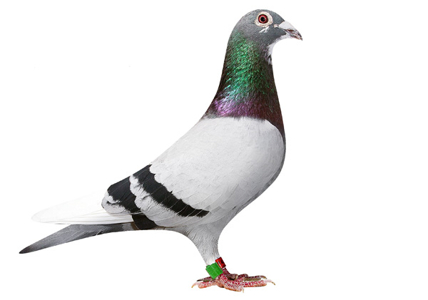
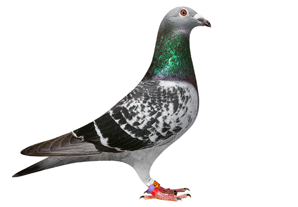
The traveling pigeons are bred by Dominique Cœur at the Aubépin in the commune of 69590 Larajasse. These birds usually participate in international competitions around the world where they fly up to 120 km / h for 750 to 1000 kilometers. They perpetuate a distant tradition, since for over 3000 years, the pigeons have transmitted messages over very long distances, carrying a piece of paper ringed to their paws from the ship of an explorer or a besieged city. These very short messages, sometimes coded, are somewhat the ancestors of tweets that circulate today from one phone to another. A poetic filiation since English tweets means chirping.
By inviting everyone to entrust his emotional geography to a traveling pigeon, Philippe Mouillon hopes to collect the planetary scale of the worlds gathered in this territory of local appearance of the Monts du Lyonnais. Each message will be mapped to the format needed to be sent by a pigeon. The release of June 25 will allow the birds to fly at the same second, and the order of arrival of the pigeons will determine an unknown hierarchical map order that will be edited as the Atlas of the worlds of each.
Atlas of the worlds of each is a proposal of Philippe Mouillon,
Produced by LABORATOIRE with the support of the DRAC Auvergne Rhône Alpes, the Department of the Rhône, the Auvergne Region Rhône Alpes, the Community of communes of the Monts du Lyonnais.
> To participate: contact@lelaboratoire.net
Apr 20, 2017 | Laboratoire en
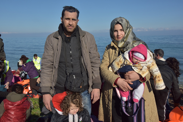
Contemporary Migrations in the Mediterranean
A multimedia device by Maryvonne Arnaud
> Original texts: Erri de Luca
> Translation: Danièle Valin
> Additional texts: Erri de Luca extracts from ALLER SIMPLE (Gallimard editions 2012)
> General design and shooting: Maryvonne Arnaud
> Editing images and sounds: Guillaume Robert
> Voices: Sophie Vaude, Jean-François Matignon, Dominique Laidet,
> Scientific Council: Anne-Laure Amilhat Szary, Alain Faure, Yves Citton
Preparatory study (May 2016): 22-minute video loop
Preview:
> At CHRD / Lyon, on 28 and 29 May 2016, at the end of the exhibition “Dreaming of another world”.
> At the cinema Utopia / Avignon, every odd day at 11 am from 7 to 25 July 2016
> To MC2 / Grenoble, during the General Assembly of Migration organized by the Cimade